
Revealing the Installation Plan for Automatic Metering Facilities in a Heilongjiang Irrigation District![Dayu Electronics]
For the automatic metering facility installation project in a certain irrigation district in Heilongjiang, the following is a brief design plan.
1. Project Overview
The project aims to install automatic metering facilities on the main canals, branch canals, and drainage canals of a certain irrigation district in Heilongjiang, with the goal of improving water measurement facilities, achieving precise calculation, and providing a scientific basis for future water pricing.
2. Design Plan
Water Level Measurement
A radar level gauge is used for water level measurement. Radar level gauges offer advantages such as non-contact measurement, high accuracy, and immunity to water quality, making them suitable for water level measurement in irrigation canal channels. During installation, an appropriate location should be selected based on the canal width and depth to ensure the accuracy of measured data.
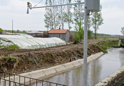
Data Acquisition and Transmission
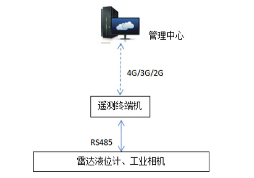
The water level data measured by the radar level gauge is collected via a remote terminal unit (RTU). The RTU should have data acquisition, storage, and transmission capabilities, enabling real-time data transmission to the management center. To ensure stable data transmission, wireless communication methods such as 4G, 5G, or NB-IoT are recommended.
Flow Calculation
The Chezy formula is used for flow calculation. The Chezy formula is a commonly used flow calculation formula applicable to open channel flow. Using the water level data measured by the radar level gauge, combined with the geometric dimensions of the canal (such as bottom width and side slope), the canal flow can be calculated. During the calculation process, the accuracy of the canal's geometric dimensions must be ensured to improve the precision of the flow calculation.
Management Center Construction
A data processing system is established at the management center to receive, store, analyze, and manage the data transmitted by the RTUs. The data processing system should have data visualization capabilities, allowing real-time display of water levels and flow rates for each canal, facilitating monitoring and decision-making by management personnel.
On-site Condition Verification
An industrial camera is connected to the RTU for real-time capturing and recording of on-site conditions. Management personnel can use photos or videos taken by the industrial camera to verify and confirm on-site conditions, ensuring the authenticity and reliability of the data.
3. Implementation Steps
Survey the canal conditions in the irrigation district, including the number, distribution, and geometric dimensions of the canals.
Based on the survey results, select appropriate radar level gauges and RTUs for procurement.
Select suitable locations on each canal for the installation and commissioning of the radar level gauges.
Establish the data processing system and conduct testing and optimization.
Perform joint commissioning of all devices to ensure data accuracy and stability.
Provide training to management personnel so they can proficiently operate and maintain the system.
4. Precautions
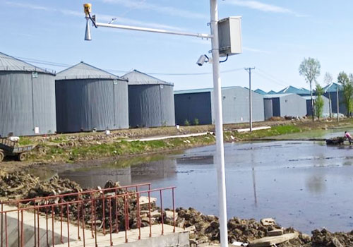
When installing the radar level gauge, consider the water flow velocity and wave conditions in the canal to avoid interference with measurements.
Regularly maintain and calibrate the radar level gauges and RTUs to ensure their normal operation and measurement accuracy.
Strengthen data security protection to ensure the security and confidentiality of data during transmission and processing.
Through the above design plan and implementation steps, the installation of automatic metering facilities in a certain irrigation district in Heilongjiang can be effectively achieved, providing strong support for precise calculation and future water pricing.