
Portable Echo Sounder Application Case[Dayu Electronics]
I. Background & Requirements
1. Traditional depth sounding pain points: Traditional depth sounding equipment (e.g., shipborne sonar, large detection instruments) relies on professional teams, with high costs and poor flexibility, making it difficult to handle complex water areas or emergency scenarios.
2. Growing market demand: Fields such as water conservancy monitoring, fishery exploration, and environmental protection management are seeing surging demand for fast, accurate depth sounding tools, especially in shallow water areas, rivers, and lakes.
3. Driven by technological innovation: Ultrasonic/laser ranging technologies are mature, and lightweight design integrated with intelligent features is driving portable echo sounders to become an industry trend.
II. Core Solutions
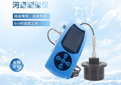
1. Lightweight design: Single-hand operation or buoy-type installation, supporting rapid deployment, compatible with shipborne, UAV, and other mounting methods.
2. High-precision measurement:
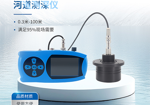
· Ultrasonic technology: Depth range 0.3m-100m, error ≤±0.05m;
· Laser technology: Suitable for turbid waters, with strong anti-interference capability.
3. Intelligent features:
· Real-time data logging and wireless transmission (Bluetooth/Wi-Fi);
· GPS positioning + map marking, generating isobath charts;
· Battery life ≥8 hours, IP68 waterproof rating.
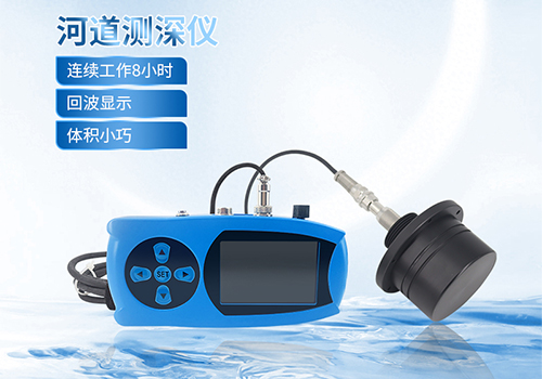
4. User-friendliness: Touchscreen interface, multi-language support, and bundled data analysis software with one-click report export.
III. Application Process
1. Equipment preparation: Power-on self-test, sensor calibration (initial use requires calibration).
2. Data collection:
· Static mode: Fixed-point measurement of water depth and flow velocity (requires a flow velocity sensor);
· Dynamic mode: Moving along a survey line, continuously recording multi-point data.
3. Scenario adaptation:
· Hydrological monitoring: Set automatic sampling frequency to generate long-term water level variation curves;
· Fishery exploration: Quickly scan fish activity areas and mark deep water zones;
· Emergency rescue: Rapidly assess river siltation or bridge damage after disasters.
4. Data processing: Import into software to generate isobath charts and 3D terrain models, with export capability to GIS systems.
IV. Usage Results
1. Efficiency improvement: Single-person operation replaces traditional team tasks, reducing project cycles by over 50%.
2. Cost optimization: Equipment procurement cost is only 1/10 of shipborne systems, with low maintenance expenses.
3. Informed decision-making: Data visualization supports planning of water conservancy projects and ecological restoration programs.
4. User feedback: In a river management project, isobath charts precisely located siltation points, improving construction efficiency by 30%.
V. Extended Value
1. Technology upgrades:
· Integrating AI algorithms for automatic detection of underwater obstacles;
· Integration with water quality sensors for simultaneous monitoring of depth, temperature, dissolved oxygen, and other parameters.
2. Scenario expansion:
· Smart cities: Real-time monitoring of urban waterlogging risk areas;
· Research: Tracking coral reef growth and fish migration routes.
3. Ecological benefits: Supports environmental agencies in assessing wetland degradation and coastal erosion, contributing to sustainable development.
Summary: With its core strengths of "precision, flexibility, and intelligence," the portable echo sounder covers needs across water conservancy, environmental protection, fisheries, and more. It is poised to become a standardized tool for water area management, driving the industry toward greater efficiency and digital transformation.