
Dayu Electronics Ultrasonic Sensor Integrated into Unmanned Surface Vehicle (USV) for Efficient Water Depth Monitoring
With the increasing demand for water environment monitoring, waterway surveying, and flood warning, traditional manual depth sounding methods are inefficient, costly, and difficult to cover complex water areas. Unmanned Surface Vehicles (USVs), with their flexibility and automation advantages, have gradually become an important tool for water area detection. To achieve high-precision, real-time water depth measurement, a hydrological research team integrated an ultrasonic underwater ranging sensor into a USV platform for automated water depth monitoring.
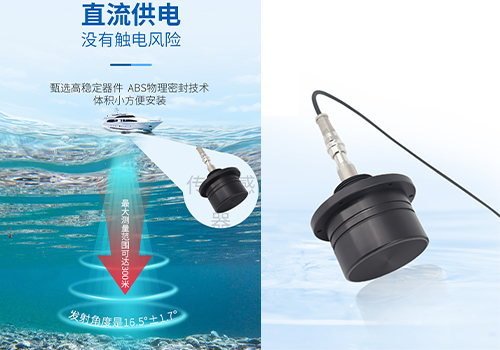
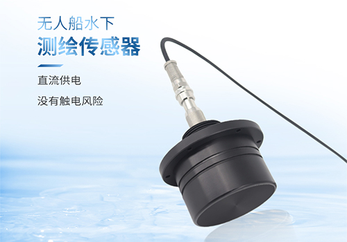
The ultrasonic sensor emits high-frequency sound waves and receives reflected signals from the bottom, calculating water depth using sound wave propagation time and the speed of sound in water (formula: Depth = Sound Speed × Time / 2). The team selected an industrial-grade waterproof ultrasonic sensor (range 0.3–50 m, accuracy ±1 cm), paired with a temperature sensor for real-time sound speed calibration (sound speed is affected by water temperature and salinity). The USV is equipped with an RTK-GPS positioning module to synchronously record centimeter-level spatial coordinates of measurement points.

1. **Sensor Integration**: The ultrasonic sensor is vertically fixed to the bottom of the USV to avoid data interference from hull motion.
2. **System Calibration**: Dynamic correction of sound speed parameters is performed in waters of known depth to eliminate multipath reflection errors.
3. **Path Planning**: An autonomous navigation system sets grid-based survey lines to cover the target water area.
4. **Real-time Transmission**: A 4G/BeiDou dual-mode communication module transmits water depth and position data to a cloud platform.
During testing, strong currents causing hull turbulence could lead to transient data anomalies. The team compensated by adding an inertial measurement unit (IMU) to correct attitude data and applied a moving average algorithm for filtering, improving the effective data rate to 98%.
In a reservoir topographic mapping project, the USV completed a 2 km² survey within 8 hours (compared to 3 days with traditional ship-mounted single-beam sonar), generating a water depth contour map with 0.5 m resolution. Compared to manual depth sounders, the average error was less than 0.15 m, meeting the requirements of the "Water Transport Engineering Survey Specifications." The data can also be used to analyze bottom sediment types (via echo intensity), supporting ecological research.
Dayu Electronics' self-developed underwater ranging sensors are widely used in USV depth sounding. Sensors with different frequencies and ranges can be selected based on field conditions.
For any questions about our depth sounding sensors, please feel free to contact us. We provide 1-on-1 model selection services.