
Multibeam Echo Sounder Provides Important Reference for Marine Engineering Exploration
Multibeam Echo Sounder, as an advanced underwater surveying device, demonstrates exceptional performance in underwater terrain surveying and marine engineering exploration thanks to its unique product features. These instruments not only deliver high-precision and high-efficiency measurement capabilities but also operate reliably in complex and variable aquatic environments, providing users with detailed and accurate underwater terrain data.
In terms of product design, the multibeam echo sounder employs advanced acoustic wave transmission and reception technology, capable of simultaneously transmitting and receiving acoustic signals at multiple frequencies. This multi-frequency measurement approach enables the instrument to penetrate water bodies of varying depths and capture subtle underwater terrain features. Meanwhile, through high-precision signal processing algorithms, the instrument accurately calculates the propagation time of acoustic waves in water, yielding precise water depth measurements.
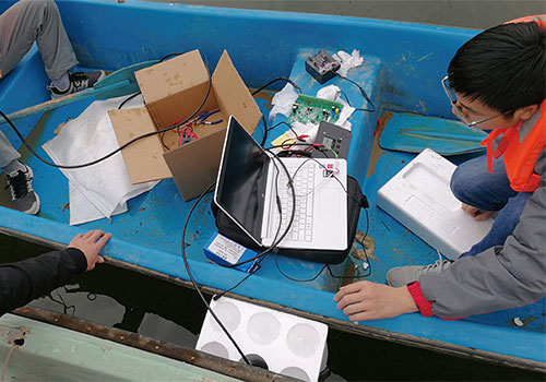
In practical applications, the multibeam echo sounder demonstrates broad applicability. For example, in river management projects, where complex and changing riverbed morphology and flow velocities pose challenges, traditional depth measurement methods often fail to accurately obtain riverbed depth information. However, the multibeam echo sounder, with its powerful measurement capability and stability, quickly and accurately acquires riverbed depth data, providing strong data support for river management.
Another typical application scenario is marine engineering exploration. In deep-sea environments, where high water pressure and low light conditions pose challenges, traditional measurement methods often fall short. The multibeam echo sounder, leveraging its multi-frequency measurement advantage, penetrates deep-sea water columns and captures seafloor terrain features. Additionally, through high-precision data processing techniques, the instrument generates detailed seafloor topographic maps, serving as a vital reference for marine engineering exploration.
In summary, the multibeam echo sounder, with its high-precision, high-efficiency measurement capabilities and broad applicability, plays an indispensable role in underwater terrain surveying and marine engineering exploration. Whether in river management or marine engineering exploration, the multibeam echo sounder provides users with accurate and reliable data support, making significant contributions to the advancement of related fields.